
Mapping Ecosystem Services for Land Use Planning, the Case of Central Kalimantan
Sumarga, E., & Hein, L.
Abstract
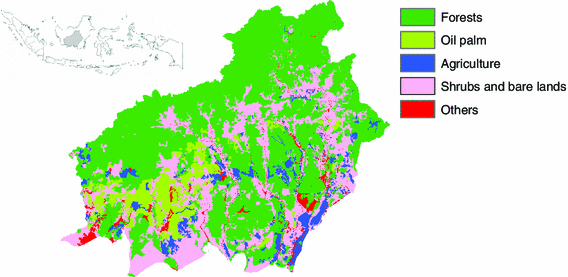
Indonesia is subject to rapid land use change. One of the main causes for the conversion of land is the rapid expansion of the oil palm sector. Land use change involves a progressive loss of forest cover, with major impacts on biodiversity and global CO2 emissions. Ecosystem services have been proposed as a concept that would facilitate the identification of sustainable land management options, however, the scale of land conversion and its spatial diversity pose particular challenges in Indonesia. The objective of this paper is to analyze how ecosystem services can be mapped at the provincial scale, focusing on Central Kalimantan, and to examine how ecosystem services maps can be used for a land use planning. Central Kalimantan is subject to rapid deforestation including the loss of peatland forests and the provincial still lacks a comprehensive land use plan. We examine how seven key ecosystem services can be mapped and modeled at the provincial scale, using a variety of models, and how large scale ecosystem services maps can support the identification of options for sustainable expansion of palm oil production.
source : Springer Science

No Comments